Bike Infrastructure East-Flanders
Make cycling great again!
The project
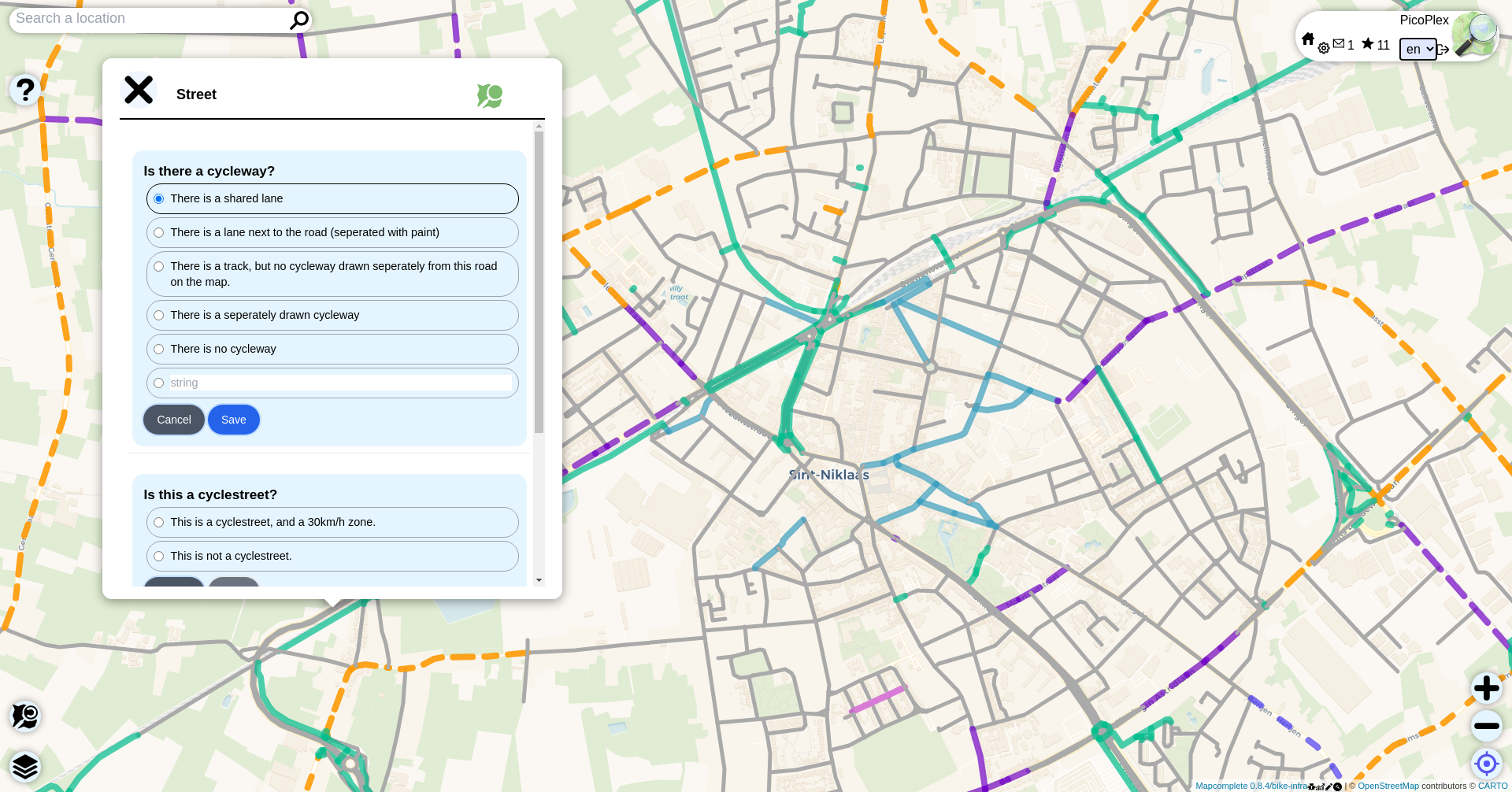
We made a mapping tool, based on OpenStreetMap and MapComplete. Using our tool, anyone can very easily add, view, and edit data about cycling infrastructure in East-Flanders. By answering simple questions, the application gathers data about the type of cycleway, the surface and quality, and any "barriers" that one might encounter.
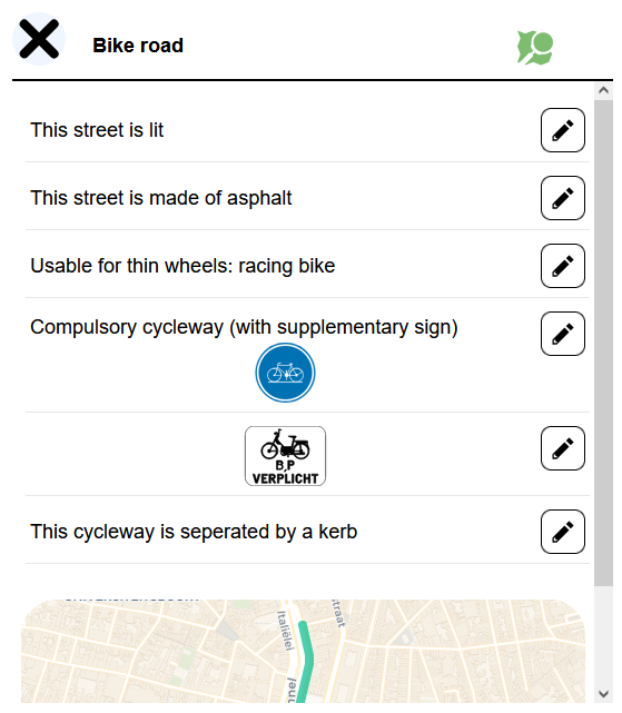
A user can answer questions about cycle infrastructure, like cycleways, traffic lights, crossings and more. If a user clicks on an element they get an overview of all the details they can edit.
Because of the simplicity of the questions, basically anyone with a computer or smartphone, can now edit the map. As of today hundreds of people have used MapComplete to edit OpenStreetMap.
Based on all the gathered data, the tool higlights different types of roads in different styles. Because of this clear style, anyone can find a route they like. Want to know more? Have a look at the project to experience it for yourself.
Demo
The team
-

Arno Deceuninck
Developer
-

Charlotte Delvaux
Developer
-

Robin van der Linde
Developer
-

Hannah Declerck
Designer